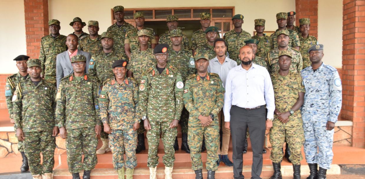
Thirty-three officers from the Uganda Peoples’ Defence Forces (UPDF) have completed a four-week geo-spatial mapping course conducted at the Headquarter Uganda Rapid Deployment Capability (HQ URDC) at Gaddafi Barracks in Jinja District.
The course brought together participants from various UPDF units and formations, aiming to enhance their proficiency in geo-spatial mapping by equipping them with practical skills to collect, visualise, interpret, and correct geographical information.
 Presiding over the closing ceremony, the Commandant of the National Defence College – Uganda, Brigadier General Alex Olupot, who represented the Chief of Joint Staff, said the training demonstrated the UPDF’s continued commitment to excellence in capacity building.
“Through HQ URDC, the UPDF has once again demonstrated its commitment to strengthening professional capacity. These specialised trainings are intended to enhance national and regional capabilities in line with international standards,” Brig Gen Olupot said.
Brig Gen Olupot observed that the course forms part of a broader effort to develop geo-spatial science capabilities within the force in order to improve operational effectiveness in an increasingly complex security environment.
 He encouraged the officers to apply the knowledge acquired to enhance data collection and support rapid response to national emergencies such as floods and landslides, as well as strengthen border security.
“The true value of this course will be measured by its impact. You must explore new opportunities presented by this dynamic technology to help address emerging challenges on the African continent,” he said.
 The Commander of HQ URDC, Brig Gen Ernest Nuwagaba, emphasised the importance of geo-spatial data in modern military operations.
“To operate effectively, you must have reliable data. Our mission is to build a formidable operational force that is well prepared, equipped, and ready to undertake national, regional, and continental peace support operations, as well as crisis response missions on behalf of the UPDF,” he said.
Brig Gen Nuwagaba noted that in 2021, HQ URDC established a geo-spatial mapping department with support from the Global Peace Operations Initiative by investing in equipment and training. While the initial focus was on producing maps, he said that the department has since evolved into a fully digital geo-spatial capability.
He added that the initiative aligns with the broader strategic objective of developing geo-mapping capacity into a national geo-spatial intelligence capability that can support policymakers, military personnel, intelligence agencies, and emergency responders through advanced geographic information systems.
The ceremony was attended by the Chief of Staff at HQ URDC, Brig Gen Flavia Byekwaso; the Deputy Chief of Staff in charge of operations at HQ URDC, Col Joseph O’Kalebo; and a representative from the Environmental Systems Research Institute East Africa, Calvin (ESRI East Africa representative), among other departmental heads.